

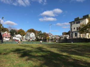
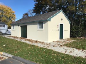
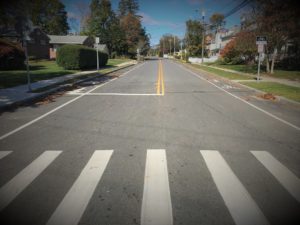
Bartlett Park Basketball Court Reconstruction
Bartlett Park basketball courts are located on Broad Street in the center of the city. The current location and configuration came about when courts at the corner of Broad Street and Connecticut Avenue had to be relocated to accommodate construction of the North Fire Station.
The project scope included replacement of existing playing surface and backboards/hoops and support poles. Previous courts were not full regulation size. The new court configuration 15 regulation 50’ x 94’, and spun 90 degrees to fit within the property. Court coloring 15 custom New London colors, matching courts recently constructed at Toby May Park.
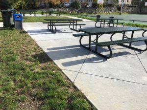
Additional amenities include installation of players’ benches around the courts and construction of two patio areas to include eight picnic tables, two of which are ADA accessible. Access to restrooms and water fountain at the Fire House are also provided.
A new sidewalk connects the courts to the recently restored Broad Street sidewalk.
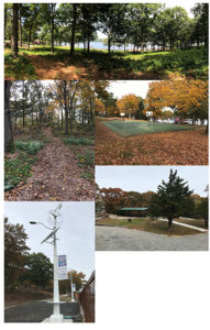
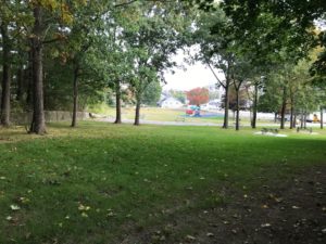
Riverside Park
The Riverside Park property was given to the City in 1907. Throughout the 20th Century, it saw periods of active recreational use, as well as periods of decline. An article in The Day in July, 1968 summed this up well, stating that “The Park, which many persons do not even know exists, is a controversial area, having both its bad reputation and some of the greatest natural beauty of any section of New London.”
In 2018, City Public Works began a rejuvenation of the park using appropriated bond funds. The initial major effort was to clear and trim the massive amount of trees that had grown unchecked for dozens of years, blocking views of the river and creating a dark, foreboding aura to the property. Work progressed from the dense rows of trees on the tiny piece of land across the railroad tracks, in sections all the way to the upper layers of the park. The resulting feeling accentuates the natural distinct levels of the park’s topography, offers breathtaking views of the river, and gives the entire property a refreshingly open and inviting atmosphere.
Other improvements include installation of a pavilion on the upper level, resurfacing of the basketball courts, creation of five parking areas framed by timber fencing, protective drainage around the playscape, installation of nine additional picnic table areas, installation of solar/wind powered combination LED lighting/personal device power stations, and creation of a walking trail.
The dangerous bathhouse on the lower level was removed, while the structure’s base was retained to accommodate a still to be determined public recreational format. The base of Adelaide Street was opened and sidewalk/handicapped vehicle access to the lower promenade was begun.
2020 will see design and construction of appropriate amenities to the lower promenade area, as well as installation of a gazebo in the middle level glade.
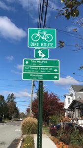
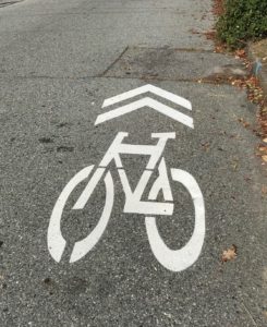
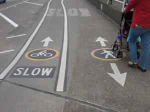
New London Bike-way Program
Over the past several months, New London has been developing and preparing for bike-friendly routes throughout the city in an effort to cut down on congestion and provide healthy transportation options for New London residents and visitors. Signage has already been erected at key locations around the city which guide bikers along the planned route. A total of 210 signs, more than 400 “sharrows” and three kiosks will direct cyclists along the route.
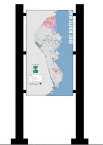
The New London Bike Plan is designed to connect with the regional network of bike routes current being planned by the Southeastern Connecticut Council of Governments. The New London bike system will connect with the regional network near the Gold Star Memorial Bridge at Bailey Circle in Hodges Square. The New London network will run from Connecticut College, through downtown and into Ocean Beach Park. Information booths with maps of the New London bike network will be located at Ocean Beach Park, Union Station and Bailey Circle. A draft of the regional bike plan is available online at https://bikewalksect.com/.
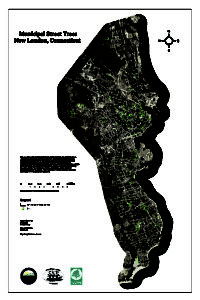
City of New London Urban Forestry Revitalization Plan and Invasive Species Best Management
The City of New London received a grant from America the Beautiful Forestry Grants to compile a comprehensive survey of New London current stock (species, age, condition, location, etc.) and produce a plan for revitalization. Under this project Connecticut College volunteers utilized field-gathering equipment to produce the inventory, under the direction of the Public Works Department. (View the study here) The City of New London Urban Forestry Revitalization Plan project is resulting in implementation of a state-of-the-art urban forestry makeover for the City.
Attached is a link to the Connecticut Invasive Plant Working Group and list of invasive plants.
CONNECTICUT INVASIVE PLANT WORKING GROUP
INVASIVE PLANT LIST
Green Harbor Beach Flood Control
Historically, intense weather events, Green Harbor Park and Beach flooded, creating a safety hazard and damaging the infrastructure of the Park and Beach. This is caused by the immense volume of storm-water that previously flowed from a large watershed area across from the Amtrak tracks, from which water flows across the park’s surface, onto the road, into two catch basins, and eventually made its way to one 24” outfall pipe situated in the midst of Green Harbor Beach.
Utilizing $1.5 million in Federal grant funds administered by the Connecticut Department of Housing, and municipal funds, the City designed and constructed a completely new drainage system that begins channeling storm-water adjacent to the railroad tracks and routes it through a series of chambers, which intersect with a new series of catch basins along both sides of Pequot Avenue, and channel it all through a 48” submerged pipe extending into the river along the northern edge of the beach.
Less than half of the existing property was previously usable for Park activities. The remainder was a saturated boggy area with highly organic soil that never dried out and as a result could not support healthy tree growth. Part of the project’s construction involved removing the boggy material, replacing with ideal drain-able soil, and seeding. This more than doubled the property’s usable space, and created impressive vistas of the beach, nearby marinas and river.
Installing new piping in Pequot Avenue, while accommodating the complex maze of existing utilities (water/gas/sewer) without disruption, was a major planning and logistical challenge. At one point, the new 48” pipe was installed more than eight feet below grade and under sewer lines, while contending with unstable soils groundwater and river water.
We appreciate the public’s patience as we carefully assemble a system that will serve the City for decades to come.

Save Money and Reduce Trash (SMART)
The City of New London received a grant from the Department of Energy and Environmental Protection – Bureau of materials Management and Compliance Assurance – to study how to develop a strong waste prevention, reuse, and recycling program. The grant funding assisted the City in advancing its waste diversion efforts through studying how to implement a new solid waste and recycling program. The grant supports public information and education, as well as potential implementation of the program. Using data from the study, the City Council appointed a Solid Waste Advisory Task Force whose mission is to Reduce Trash, Increase Recycling, and achieve community support.
LEARN MORE (FAQs)
VIEW PRESENTATION – SMART Program
VIEW PRESENTATION – Reducing Waste in New London
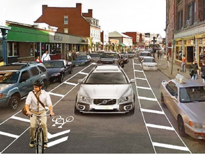
Downtown Traffic & Parking
Improvement Plan
The City of New London implemented a new traffic pattern on a trail basis on Bank Street between Tilley Street and State Street, effective Thursday, July 27, 2017.
The new traffic design is intended to ease congestion and aggressive driving, better facilitate on-street parking, increase pedestrian safety, promote development, and improve the image of the central Bank Street business district.
Bank Street was restriped between Tilley and State Streets to enable a shared bicycle lane with one (1) traffic/travel lane, as well as create “buffer” areas so passengers can safely exit their vehicles without disrupting traffic flow.
READ MORE
Multi-Use Path
The City of New London is planning a multi-use combined impervious Pedestrian and Bile Path Trail from City Pier to behind Shaw’s Landing Condominiums. This project is the initial phase of a plan that will enable walking and bike paths connecting City Pier to Fort Trumbull.
The City was awarded a $61,650 grant from the State of Connecticut, Department of Energy and Environmental Protection to provide final plans and construction documents for the one-half mile (1 mile round trip) trail.
Anchor Engineering was awarded the contract and is developing plans. Once plans are complete, the City will apply for additional grant funding for construction of the path.
LEARN MORE
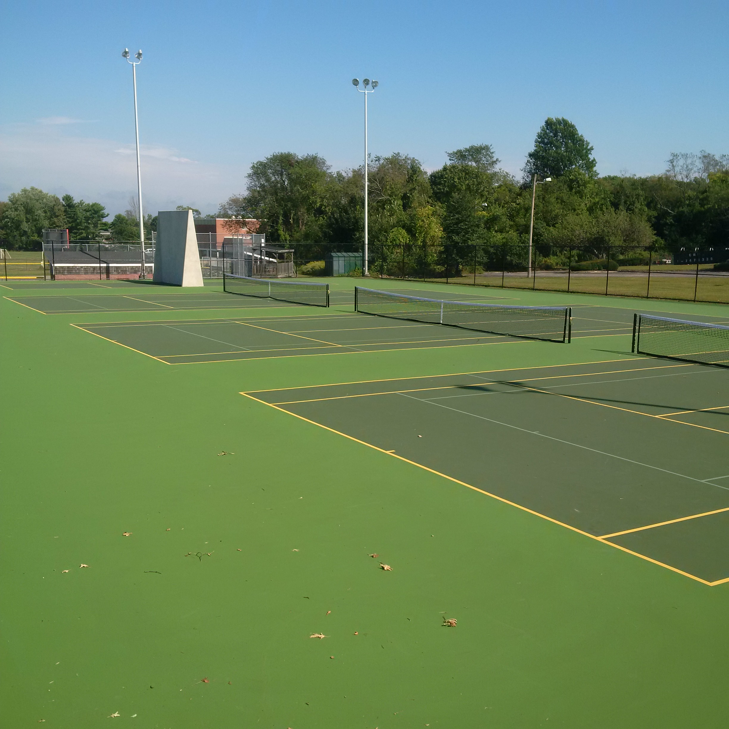
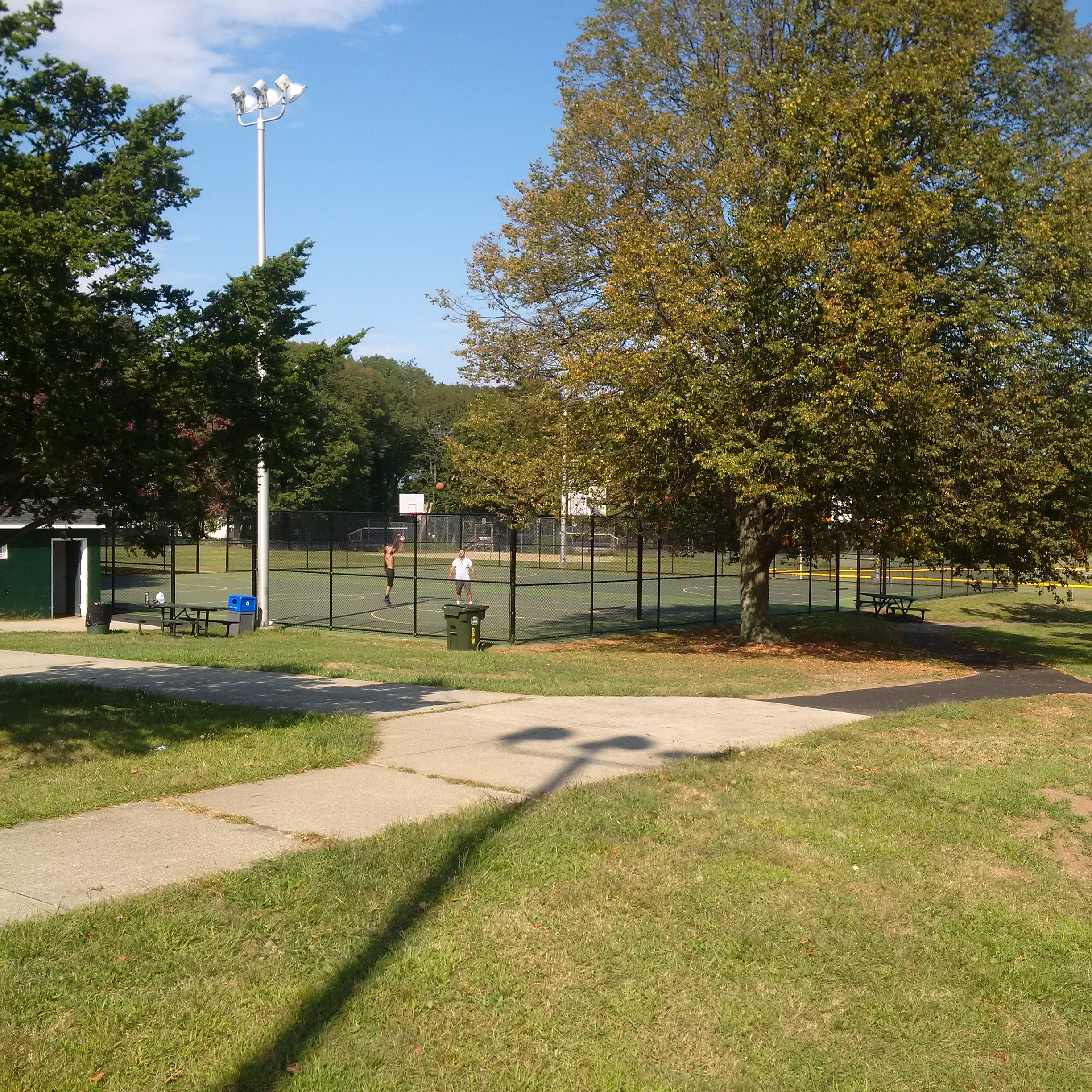
Toby May Basketball/Tennis/Handball Courts
Basketball and tennis courts at Toby May Park have been completely reconstructed and resurfaced. A new handball court has been constructed at the direction of the Parks and Recreation Commission.
With proper and responsible use, the courts should provide quality recreational service for years to come. The City has already been contacted by the New England Handball Association, which has expressed interest in holding regional handball clinics and competitions here.
LEARN MORE
Municipal Parking Lots
In July 2016, the City of New London embarked on an ambitious project to redesign and construct two municipal parking lots along Eugene O’Neill Drive which back up to Bank Street, one of the City’s main commercial thoroughfares.
The new lots feature several innovative design and functioning elements. These include center islands serving as “rain garden” storm water collection basins, the use of “Silva cells” (sub-grade plastic cages) to provide a healthy growing environment for newly planted trees, classically styled brick entry nodes, and the addition of decorative lighting fixtures that match existing lighting designs along Bank and State Street, serving to visually connect the parking lot with area commercial establishments.
Construction of the lots is complete. Hanging flower baskets have been installed to match with the adjacent city downtown district design. Future installation of artwork at the entrance at the intersection of Pearl Street and Eugene O’Neill Drive completed the project!
LEARN MORE
L.E.D. Streetlight Conversion
 Rendering of previous H.P.S. lighting. |
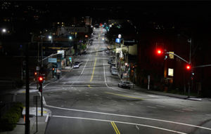 Rendering of new L.E.D. lighting. |
In 2016, Public Works administered the conversion of 2200 HPS (High Pressure Sodium) “Cobra Head” style streetlights, and 388 Decorative streetlights, to LED (Light Emitting Diode) fixtures. This initiative, funded through a $1.2 million bond, includes $426,000 in rebates from Eversource , and an annual reduction of more than a million kwh/hr., resulting in an estimated $175,000 annual savings in cost of electricity. L.E.D.s emit a more natural light color, and illuminate a more general area, resulting in increased safety and quality of life.
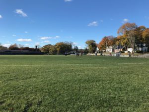
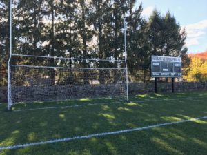
Veteran’s Field Renovation
Veteran’s Field served as a key recreational center during the mid-20th century, including the venue for New London High School games. In recent years it served as the staging area for portable educational buildings and then lay fallow, unable to be easily upgraded because it sat on the site of an ancient landfill. The renovation project, which includes fields and associated infrastructure, including a clubhouse with restrooms, was completed in early 2019 and served the City throughout the 2019 Recreation Season.
Ocean Avenue Reconstruction
In 2015/2016, the City applied for and was awarded a LOTCIP (Local Transportation Capital Improvement) grant to completely reconstruct Ocean Avenue between Niles Hill Road and Neptune Avenue, estimated at a cost of $2,162,999.40. The State DOT has approved the City’s design and authorized contract award.
The project has been completed and is certified for a minimum service life of 20 years.
VIEW PRESENTATION
READ PRESS RELEASE
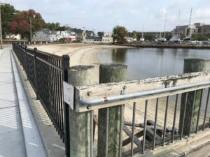
Shaw’s Cove Steel Pile Wall Reconstruction
A corrugated metal retaining wall in Shaw’s Cove was installed in 1976 as a critical infrastructure component in the City’s Flood Control Plan. It includes a Cathotic Protection system that deteriorates with salt water and wave action to act as a guide to determine when the wall needs to be replaced.
Based on the condition of the Cathodic system, in 2016 the City applied for and received a $160,000 grant funded by the U.S. Department of Housing and administered through the State of Connecticut Department of Housing to perform engineering studies to accurately ascertain the condition of the wall and to prepare bid documents for its repair. GZA GeoEnvironmental, Inc. has completed technical on-site analysis and is preparing an assessment report with recommendations on repair and maintenance options.